Satellite Intelligence for Insurance
Satellite Club gives insurers, reinsurers, brokers and claims professionals access to Skytek’s Earth Observation expertise, satellite imagery and analytical capability.
Satellite imagery can provide independent evidence when conventional information is unavailable, incomplete or disputed. Finding the right imagery and interpreting it correctly, however, requires specialist knowledge.
Skytek manages the complete process, we identify and source the most appropriate satellite data, carry out the analysis and deliver the findings in a clear, insurance-focused report.
Four Fundamental Questions
What happened?
Where did it happen?
When did it happen?
What has been affected?
From a single asset to a major catastrophe or an entire geographical region, Satellite Club can provide independent intelligence anywhere in the world.
Independent Intelligence When It Matters
- Satellite imagery
- Earth Observation data
- Geospatial intelligence
- Advanced analytics
- Specialist interpretation
The service can support underwriting, claims, catastrophe response, investigations, monitoring and dispute resolution.
Skytek selects the most appropriate technology and data source for each assignment, so clients do not need to understand satellite systems or imagery procurement themselves.
Satellite imagery
Skytek analysis
Insurance report
Claims & Damage Assessment
Independent evidence to support claims decisions
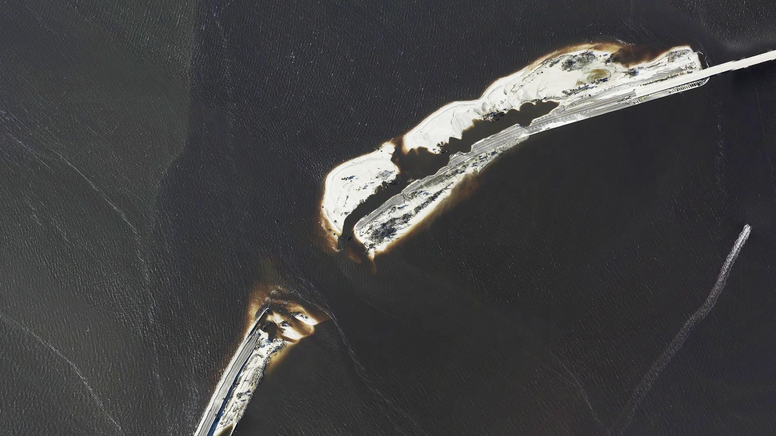
Use pre-event and post-event imagery to establish the condition of an insured asset and assess what changed following an incident.
- Fire
- Explosion
- Severe weather
- Natural catastrophe
- Conflict
Skytek can identify the location and extent of visible damage, helping claims teams assess potential loss and validate available information.
This can be particularly valuable when physical access is restricted, delayed or unsafe.
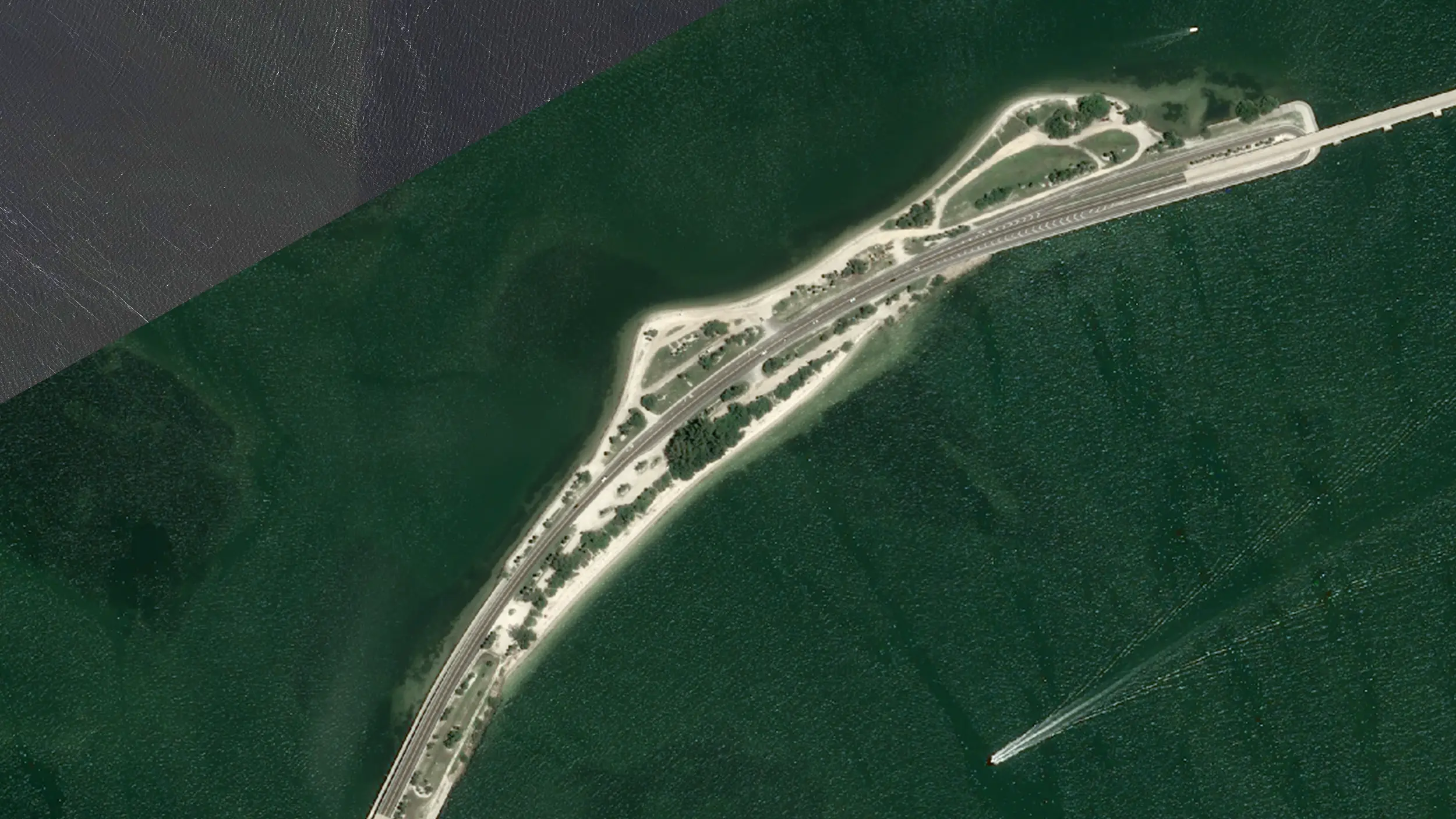
Pre-Event Image: August 22nd, 2022 of the Sanibel Causeway – Credits @AirbusSpace
Post-Event Image: September 30th, 2022 of Sanibel Causeway – Credits @ NOAA
Marine Casualty Intelligence
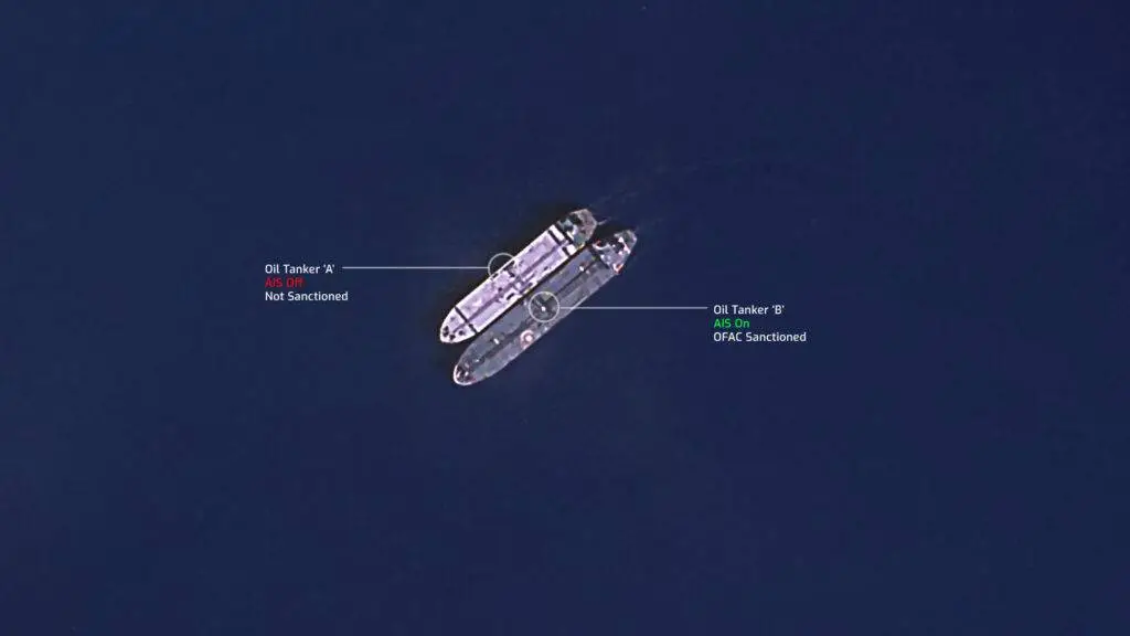
Locate, investigate and assess vessels from space
- Locate vessels
- Reconstruct movements
- Review vessel condition
- Confirm vessel positions
- Assess visible damage
- Investigate activity around the incident
Catastrophe & Event Response
Understand the scale of an event quickly
- Map the affected areas
- Identify exposed assets
- Assess visible damage
- Estimate the scale of impact
- Support claims and response planning
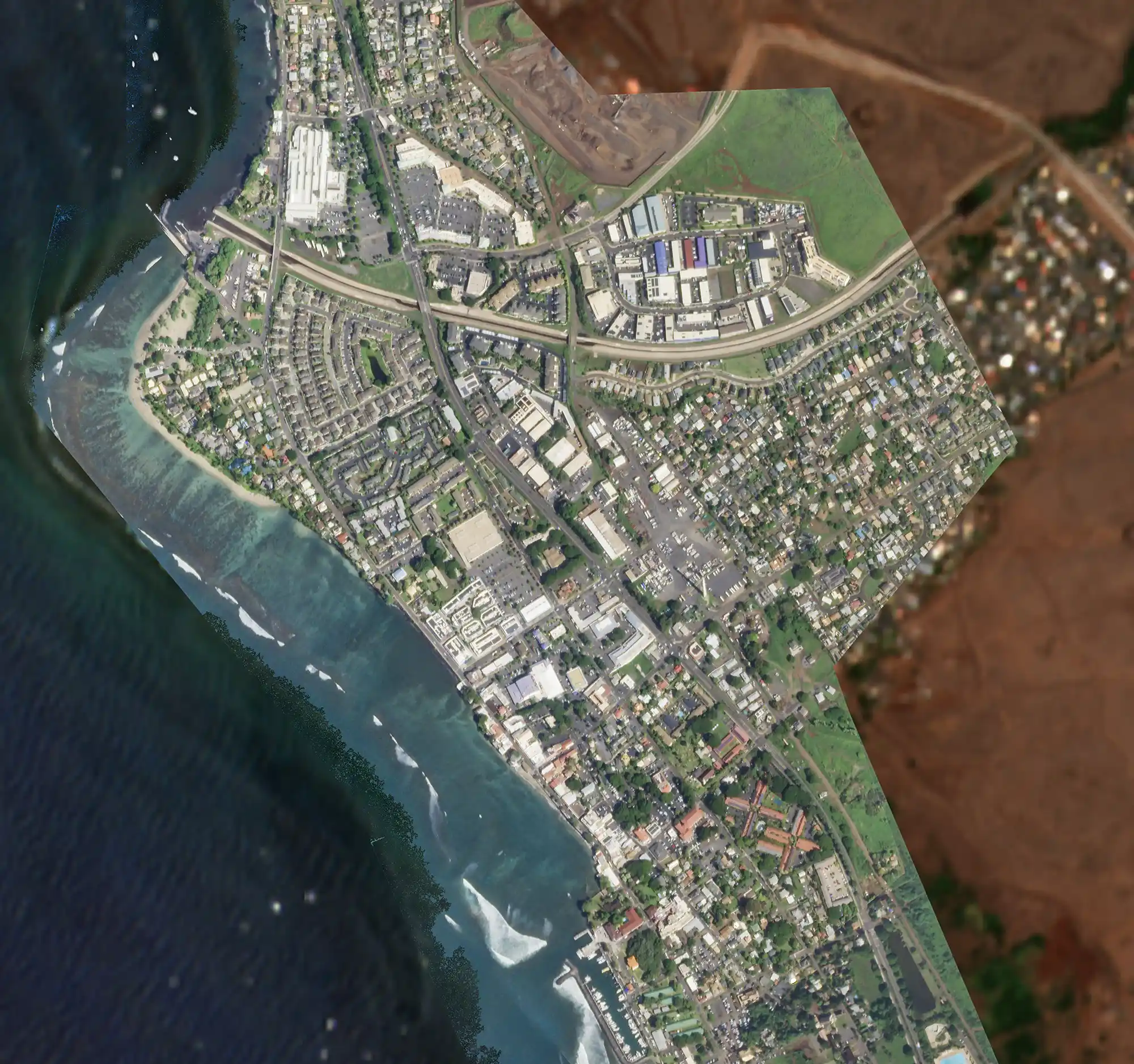
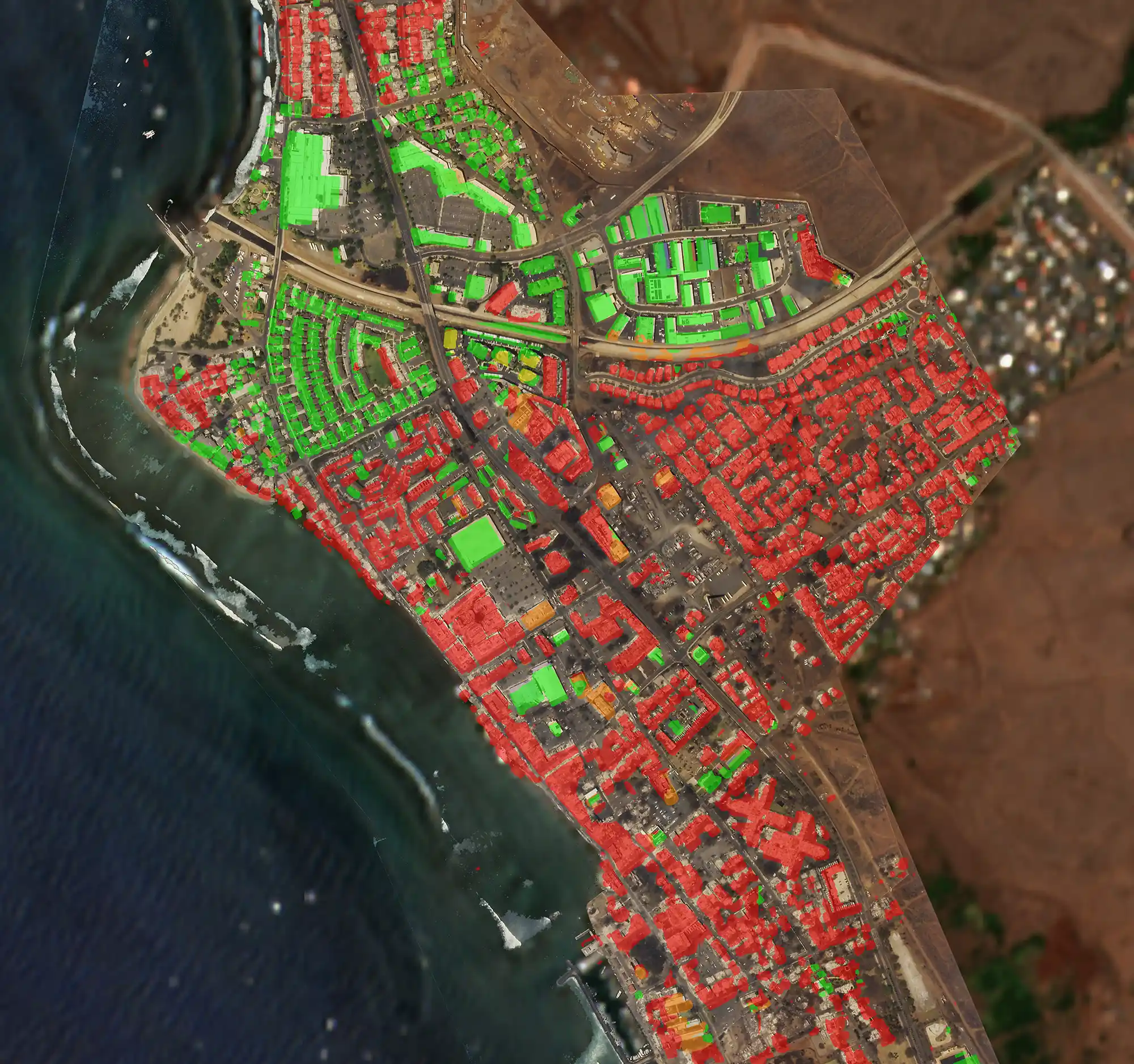
Pre-Even Image: Planet Labs satellite imagery of Lahaina city on February 02nd, 2023.
Post-Event Image: Planet Labs satellite imagery of Lahaina city, damage overlay on August 15th, 2023

Underwriting & Risk Intelligence
See the risk before you insure it
- Property
- Ports
- Infrastructure
- Industrial Facilities
- Energy assets
- Vessels
- Other geographically identifiable risks
Historical imagery can also show how a location has changed over time, providing additional context where conventional underwriting information may be limited.
Monitoring & Change Detection
See what is changing on the ground
- Physical changes
- Movement patterns
- Emerging conditions around an insured risk
- New construction or activity
- Changes to infrastructure
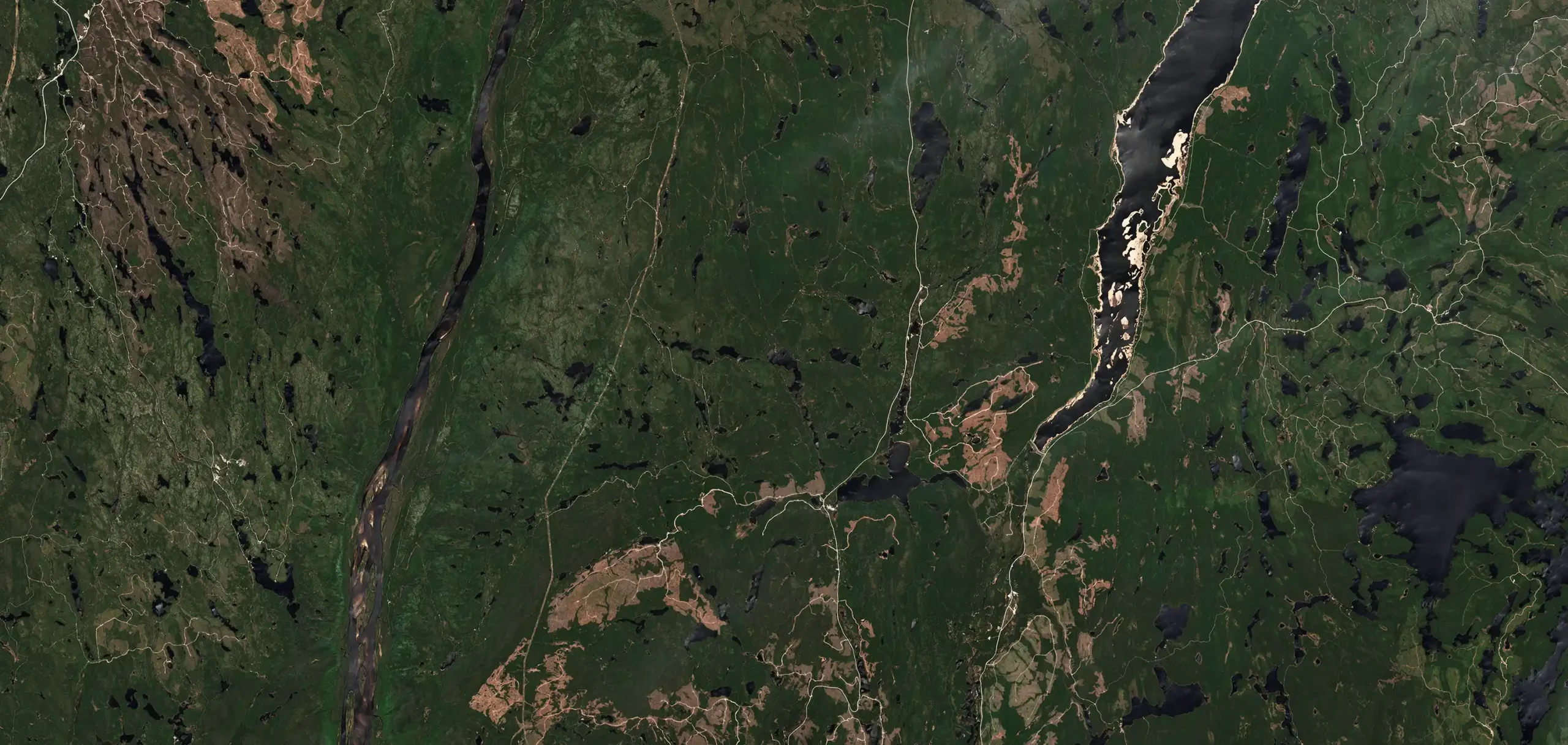
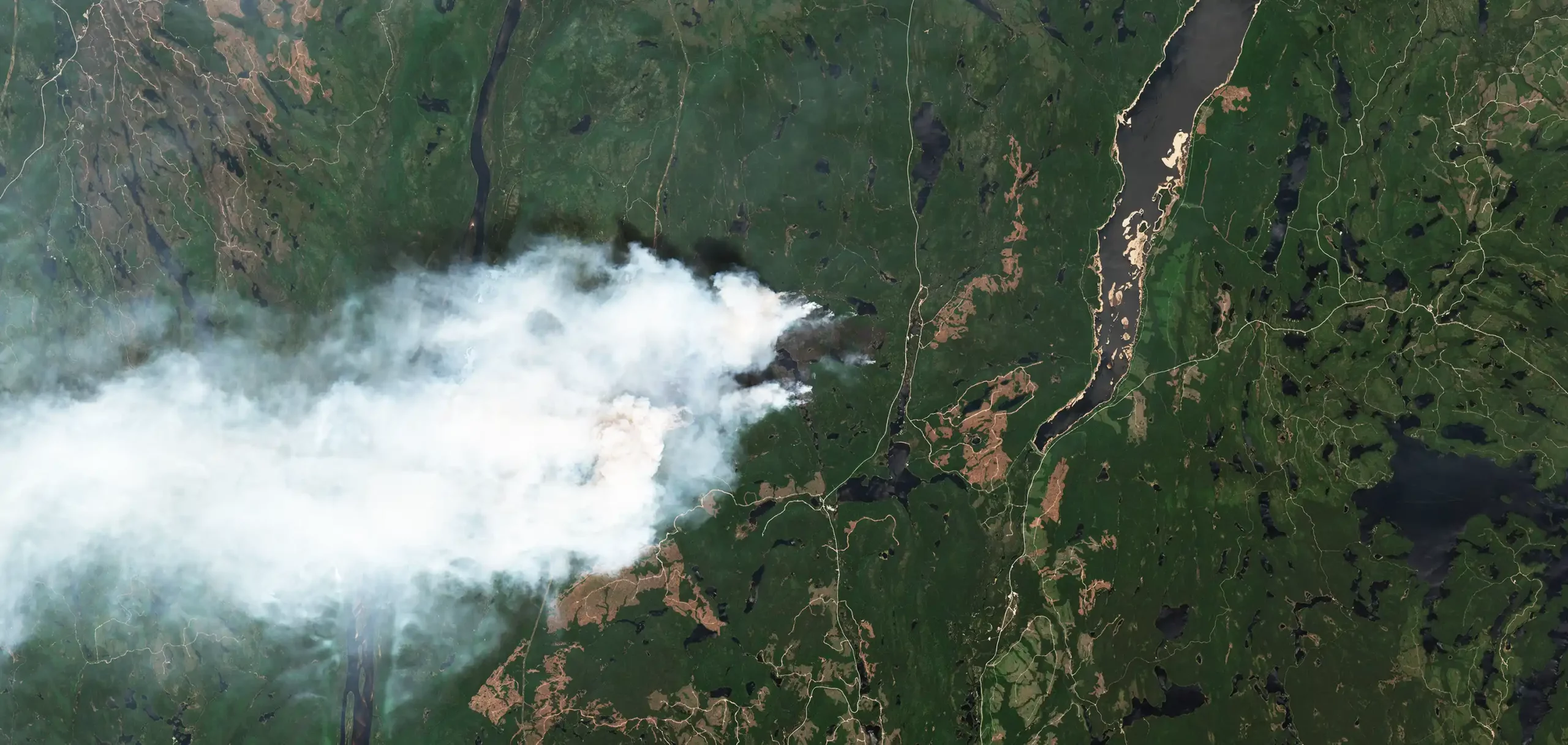
Canadian Wildfires: Sentinel 2 satellite image – May 30th, 2023
Canadian Wildfires: Sentinel 2 satellite image – June 04th, 2023

Environmental & Climate Intelligence
Observe environmental change from space
- Flooding
- Wildfires
- Drought
- Emissions
- Greenhouse gases
- Other environmental risks
Dispute Resolution & Expert Evidence
Independent evidence for complex claims and disputes
- Claims disputes
- Historical investigations
- Legal proceedings
- Legal defence
- Expert evidence
Reports can combine historical and current satellite imagery with other relevant data to establish a clear evidence base for further investigation or proceedings.


Bespoke Intelligence
Intelligence built around the question
- Optical satellite imagery
- Synthetic Aperture Radar
- Historical imagery
- Geospatial data
- Complementary intelligence sources
FROM SATELLITE TO DECISION
We Manage the Complexity
Clients do not need to identify the satellite, select an imagery provider or determine which technology is best suited to the investigation.
Skytek manages the process from start to finish.
01
Establish what the client needs to understand or prove.
02
03
04
05
Cross-check the findings against other available sources where required.
06
Report
Present the findings clearly for underwriting, claims, investigation or legal use.
Different investigations require different forms of Earth Observation. Satellite Club can use one or several technologies depending on the assignment.
Detailed visual imagery for assessing assets, infrastructure, physical conditions and visible damage.
Radar imagery capable of observing the Earth’s surface through cloud and during darkness. Particularly useful for vessel detection, flood mapping, change detection & poor weather monitoring.
Review previous conditions at a location, establish a pre-event baseline and identify changes over time.
Satellite Expertise Applied to Insurance
Find Out How Satellite Club Can Benefit Your Organisation